Map of Central America: Countries, Capitals & Travel Tips
If you’re staring at a map of Central America and wondering where each country sits, you’re not alone. That thin strip of land—just 523,000 square kilometers—holds seven distinct nations, each with its own capital, language, and travel personality.
Number of countries: 7 ·
Largest country by area: Nicaragua (130,373 km²) ·
Smallest country by area: El Salvador (21,041 km²) ·
Only non-Spanish-speaking country: Belize (English) ·
Total population (approx.): 50 million ·
Total area: 523,000 km²
Quick snapshot
- Central America has seven countries (Encyclopædia Britannica (established reference))
- Nicaragua is the largest by area at 130,373 km² (Infoplease (atlas reference))
- Exact safety rankings vary by year; consult current U.S. State Department advisories (U.S. Department of State (federal travel advisory))
- Best time to visit can differ between Pacific and Caribbean coasts (U.S. Department of State (federal travel advisory))
- December to April is the dry season across most of the region, making it the peak travel window (Encyclopædia Britannica (geographic reference))
- Hurricane season runs June to November, especially affecting coastal Belize and Honduras (Encyclopædia Britannica (geographic reference))
- Check country-specific safety advisories before booking flights (U.S. Department of State (advisory portal))
- Plan around rainy vs dry season depending on your itinerary (U.S. Department of State (advisory portal))
Here is a summary of the most essential facts uncovered so far.
| Fact | Value |
|---|---|
| Total countries | 7 |
| Largest country | Nicaragua (130,373 km²) |
| Smallest country | El Salvador (21,041 km²) |
| Only English-speaking | Belize |
| Safest for tourists | Costa Rica |
| Peak travel season | December to April (dry season) |
What are the 7 countries in Central America?
Seven nations make up this isthmus between North and South America, bordered by the Caribbean Sea on the east and the Pacific Ocean on the west (Encyclopædia Britannica (geographic authority)).
List of Central American countries and their capitals
- Belize – Belmopan (Harvard Face Surgery Map (educational resource))
- Costa Rica – San José
- El Salvador – San Salvador
- Guatemala – Guatemala City
- Honduras – Tegucigalpa
- Nicaragua – Managua
- Panama – Panama City
Quick reference: location on the map
Reading left (northwest) to right (southeast): Guatemala shares borders with Mexico and Belize; Belize sits on the Caribbean coast east of Guatemala; Honduras lies east of Guatemala; El Salvador is on the Pacific side of Honduras; Nicaragua stretches between both coasts; Costa Rica sits south of Nicaragua; Panama is the southernmost, linking to Colombia (Infoplease (atlas guide)).
A traveler scanning a physical map sees seven puzzle pieces; the real takeaway is that each country’s geography—mountains, coasts, rainforests—shapes its travel appeal and accessibility.
What are the three largest countries in Central America?
When you rank the seven by land area, three nations dominate. Nicaragua takes the top spot, followed by Honduras and Guatemala (Infoplease (size data)).
Size ranking of Central American countries
| Rank | Country | Area (km²) |
|---|---|---|
| 1 | Nicaragua | 130,373 |
| 2 | Honduras | 112,492 |
| 3 | Guatemala | 108,889 |
| 4 | Panama | 75,417 |
| 5 | Costa Rica | 51,100 |
| 6 | Belize | 22,966 |
| 7 | El Salvador | 21,041 |
Geographic diversity by size
The largest, Nicaragua, contains the vast Lake Nicaragua and dense rainforests. Honduras is mountainous with a long Caribbean coast. Guatemala packs volcanoes and Mayan ruins into its 108,889 km² (Encyclopædia Britannica (regional geography)). By contrast, El Salvador—the smallest at 21,041 km²—is the most densely populated and the only one without a Caribbean coastline.
A traveler who favors hiking and volcanoes will gravitate toward Guatemala and Costa Rica; one who wants remote beaches and big lakes will find them in Nicaragua. Size dictates not just landscape but trip duration.
What is the only country in Central America that doesn’t speak Spanish?
One country stands out linguistically: Belize. English is its official language, a legacy of British colonial rule. The other six nations—Guatemala, El Salvador, Honduras, Nicaragua, Costa Rica, and Panama—all have Spanish as the official language (Harvard Face Surgery Map (language reference)).
Belize: official language and history
Formerly British Honduras, Belize gained independence in 1981. English is used in government, schools, and media, though Belizean Creole is widely spoken in daily life. The country’s Caribbean orientation—rather than Pacific—makes it culturally distinct from its neighbors.
Other languages spoken in Central America
Indigenous languages such as K’iche’, Q’eqchi’, and Miskito are spoken across Guatemala, Honduras, and Nicaragua. In Panama, you’ll hear Ngäbere and other native tongues. Costa Rica’s indigenous population is smaller, but BriBri is still spoken in the southern Talamanca region (Encyclopædia Britannica (cultural data)).
Travelers who assume Spanish is mandatory everywhere will be pleasantly surprised in Belize—but they’ll miss out on the linguistic richness of Guatemala’s highlands, where Maya languages are everyday, not museum pieces.
What is the safest country in Central America to visit?
Safety is the top concern for most travelers. Based on U.S. State Department advisories and traveler reports, Costa Rica consistently ranks as the safest Central American destination for tourists (U.S. Department of State (Costa Rica advisory)).
Safety ranking overview
The State Department assigns advisory levels from 1 (normal precautions) to 4 (do not travel). As of 2023, Costa Rica is Level 2 (exercise increased caution). Panama also holds a Level 2. Belize is Level 2 due to crime in Belize City. Guatemala, Honduras, and Nicaragua are Level 3 (reconsider travel). El Salvador was Level 3, but recent security improvements have shifted its risk profile (BBC News (international news organization)).
Costa Rica and Panama as top picks
Costa Rica’s established tourism infrastructure, stable government, and emphasis on eco-tourism make it the safest bet for first-time visitors. Panama offers modern infrastructure in Panama City and well-traveled routes to the canal and San Blas Islands. Both countries have lower violent crime rates than their northern neighbors (U.S. Department of State (Panama advisory)).
Practical safety tips for travelers
- Stay in well-reviewed accommodations in tourist zones.
- Avoid walking alone at night in cities like San Salvador, Tegucigalpa, and Guatemala City.
- Use registered taxis or ride-share apps rather than public transport in high-crime areas.
- Register with your embassy’s travel program for real-time alerts.
“Violent crime—such as homicide, armed robbery, and kidnapping—is common in Honduras. Gang activity is widespread.”
— U.S. Department of State (security warning)
“El Salvador has seen a dramatic drop in homicides since the government launched a massive crackdown on gangs in 2019.”
A low advisory level doesn’t mean zero risk. Even in Costa Rica, petty theft is common on beaches and in crowded markets. The best strategy: treat every country with the same street-smart caution you’d use in any unfamiliar city.
When not to go to Central America?
Timing can make or break a trip. The rainy season stretches from May to November across much of the region, with a particularly intense hurricane window from June through November (Encyclopædia Britannica (climate data)).
Rainy season months by country
| Country | Rainy season | Peak rainfall |
|---|---|---|
| Belize | May – November | June – October |
| Costa Rica | May – November | September – October |
| El Salvador | May – October | June – August |
| Guatemala | May – October | June – September |
| Honduras | May – November | June – October |
| Nicaragua | May – November | September – October |
| Panama | May – November | October – November |
Hurricane season impact
Hurricanes primarily affect the Caribbean coast of Belize, Honduras, and Nicaragua. Storm surges can flood low-lying areas, and heavy rains trigger landslides in mountainous regions. The Pacific coast, where Costa Rica and Panama sit, rarely experiences direct hurricane hits but still gets heavy rain.
Peak tourist crowds
Dry season (December to April) coincides with winter holidays and spring break, driving up prices and crowding popular destinations like Manuel Antonio in Costa Rica and Tulum in Mexico (not Central America, but often combined). If you prefer fewer crowds, consider the ‘green season’ (May to June) when rain is lighter and rates drop sharply (Responsible Travel (travel guide)).
Seven countries, one isthmus—but the map only tells you where things are, not when to go or how safe they are. The implication: your ideal Central America itinerary depends more on timing and risk tolerance than on geography alone.
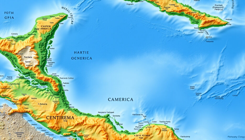
For a comprehensive overview of the region, you can refer to this detailed map of Central America that includes safety rankings and travel advice.
Frequently asked questions
What currency is used in Central America?
Each country has its own currency, though U.S. dollars are widely accepted in tourist areas. Belize uses the Belize dollar, Guatemala the quetzal, Honduras the lempira, El Salvador and Panama use the U.S. dollar, Nicaragua uses the córdoba, and Costa Rica uses the colón.
Do I need a visa to travel to Central America?
Citizens of the U.S., Canada, and most European countries can enter visa-free for stays up to 90 days in most Central American countries. Always check current entry requirements on the embassy website of your destination.
Is Central America part of North America?
Yes, geographers classify Central America as a region of the North American continent. It sits on the Caribbean tectonic plate and is considered the southernmost part of North America (Encyclopædia Britannica (continent classification)).
What is the smallest country in Central America?
El Salvador is the smallest by land area at 21,041 km², though it is the most densely populated (Infoplease (size data)).
Which Central American country has the most volcanoes?
Guatemala has the highest number, with 37 volcanoes, several of which are active, including Volcán de Fuego, which erupts regularly (Encyclopædia Britannica (volcanic activity)).
Are there any Central American countries without an army?
Yes, Costa Rica abolished its military in 1949 and Panama has no standing army since the 1990s. Both rely on police and security forces for defense (Encyclopædia Britannica (government data)).
What is the best way to travel between Central American countries?
Buses are the most common and affordable option, with services like Tica Bus connecting all capital cities. Flights save time but cost more. Driving the Pan-American Highway is possible, but border crossings can be lengthy.
How long does it take to drive across Central America?
Driving the roughly 3,000 km from Guatemala’s border with Mexico to Panama’s Darien Gap takes about 3-4 weeks if you stop at cities and sights. The Darien Gap itself is impassable by road, so you must ship your car or take a ferry from Panama to Colombia.
For a traveler mapping out a Central America trip, the choice is clear: plan around the dry season and check current advisories per country, or risk getting your itinerary rained out. Related: Where Is the Amazon Rainforest · HM Alma de Bayahibe: Adults-Only All-Inclusive Resort
More related posts
 The Keg Gift Card: Balance Check, Buy & Usage Guide
 Cast of The Terminal List: Dark Wolf – Full Cast & Characters
 A Million Little Things – Cast Seasons Episodes Guide
 NyQuil Cold and Flu – Ingredients, Dosage, Side Effects Guide
 Sonic the Hedgehog 2 – Complete Guide to Zones and Secrets
 S&P 500: Returns, ETFs & What If You Invested $1000?