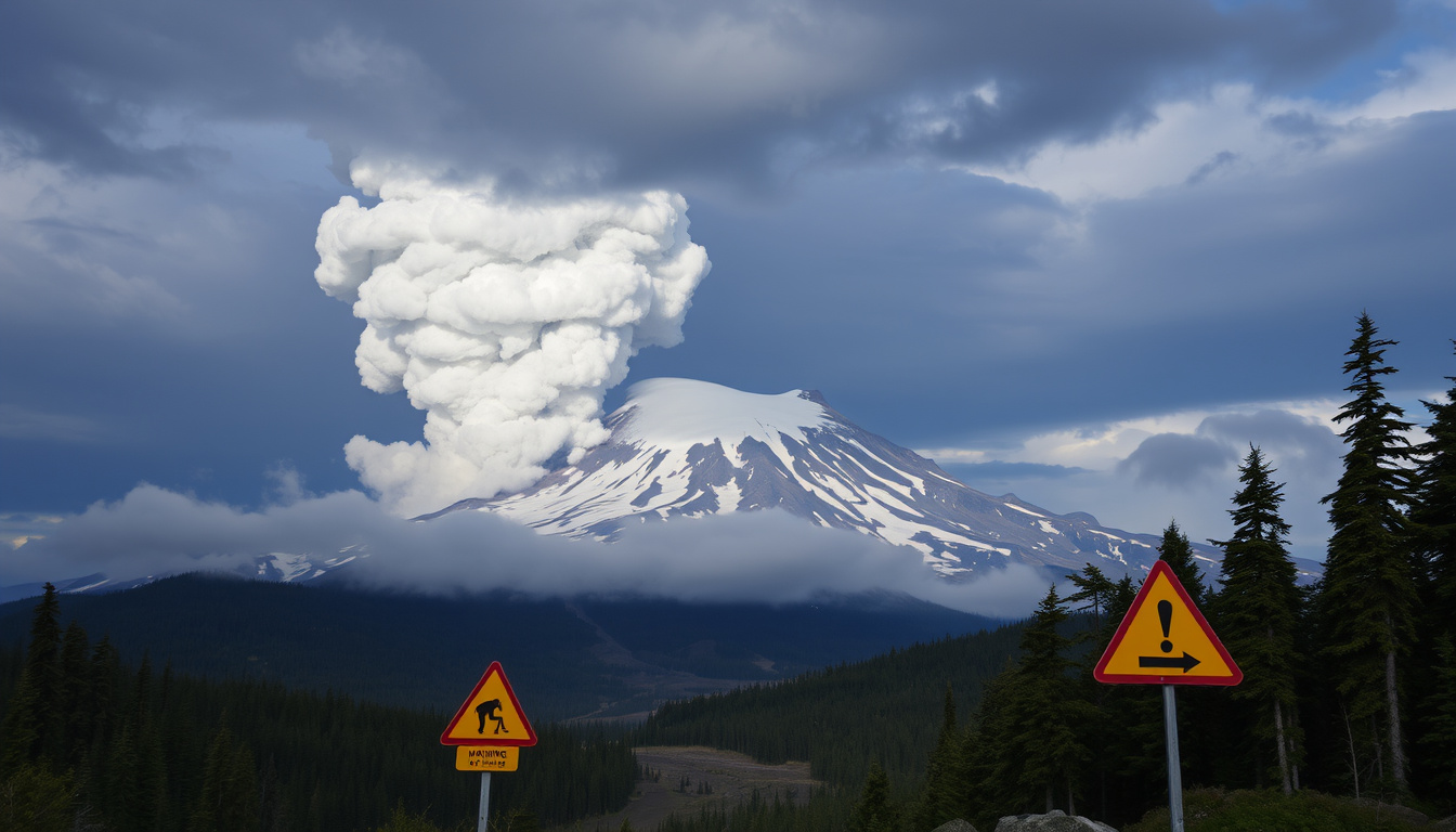
Most Seattleites see Mount Rainier as a 14,406-foot scenic backdrop, but volcanologists see a stratovolcano with hydrothermally weakened slopes that could send a lahar through the suburbs of Tacoma in under an hour. This guide breaks down the research on eruption risk, the lahar threat to the 150,000 people in the valleys below, and the climbing fatality record that has made Rainier one of the most talked-about peaks in the United States.
Elevation: 14,406 feet (4,392 m) · Volcano type: Active stratovolcano · Last eruption: ~1,000 years ago · Primary hazard: Lahars · Climbing fatalities (since 1899): Over 400 · Closest major city: Seattle, WA (85 km east-southeast)
Quick snapshot
- Active stratovolcano with large eruption history (U.S. Geological Survey)
- Lahars are the greatest threat to downstream communities (U.S. Geological Survey) (U.S. Geological Survey)
- Over 400 climbing fatalities recorded since 1899 (National Park Service)
- Exact number of unrecovered bodies on the mountain remains unknown
- Precise eruption date within the last 2,000 years is not pinpointed
- Whether the next eruption will occur in decades or centuries is uncertain
- Last confirmed eruption ~1,000 years ago (U.S. Geological Survey)
- Lahar detection system installed in Pierce County in 1998 (U.S. Geological Survey)
- Continuous monitoring by USGS CVO since the 1960s
- USGS continues real-time seismic and gas monitoring (U.S. Geological Survey)
- Community evacuation drills continue in lahar-prone towns
- Ongoing research into hydrothermal weakening of the volcano’s west flank
Eight key facts at a glance, one pattern: the data points to a volcano that is quiet but far from dormant.
| Attribute | Value |
|---|---|
| Elevation | 14,406 feet (4,392 m) |
| Location | Washington state, Cascade Range |
| National park | Mount Rainier National Park |
| Last eruption | ~1,000 years ago |
| Number of glaciers | 25 |
| Closest city | Seattle (85 km) |
| Climbing fatalities total | Over 400 |
| Primary hazard | Lahars (volcanic mudflows) |
When was the last time Mount Rainier erupted?
The last confirmed eruption of Mount Rainier occurred approximately 1,000 years ago, during the late Holocene period, according to the U.S. Geological Survey (USGS) volcano hazards program. No historical eruptions have been recorded since European settlement, though steam emissions have been observed from the summit crater.
Timeline of Mount Rainier eruptions
- ~1,000 years ago: Last confirmed eruption (USGS CVO)
- ~500 years ago: Electron Mudflow — a large lahar that traveled down the Puyallup River valley (USGS Scientific Investigations Report 2009-5211)
- 1899: First recorded climbing fatality on the mountain
- 1946: Plane crash on the glacier — no survivors recovered
- 1960s–present: Continuous monitoring by the USGS Cascades Volcano Observatory
- 1998: Lahar detection system installed in Pierce County
Eruption style and magma composition
Mount Rainier is an andesitic stratovolcano, meaning it produces viscous lava that tends to build steep cones and generate explosive eruptions. The USGS Open-File Report 2007-1220 notes that hazard zones can include lava flows, pyroclastic flows, debris flows, lahars, flooding, and post-eruption sedimentation depending on the event type and valley geometry. The volcano’s extensive glacial cover — 25 major glaciers — amplifies the lahar risk because meltwater mixes with volcanic debris to create fast-moving slurries.
A long quiet period does not mean a volcano is safe. Rainier’s last eruption was a millennium ago — but the Electron Mudflow, a lahar event, happened only 500 years ago, proving that the volcano can generate catastrophic flows without a full-scale eruption.
The implication: Mount Rainier’s threat profile is dominated by lahars, not lava. The volcano can cause immense damage without ever producing a classic eruption column.
Is Mount Rainier likely to erupt again?
Yes — and the USGS ranks it as one of the most dangerous volcanoes in the United States precisely because of its history of activity and the population density in its shadow. The USGS Cascades Volcano Observatory states that Rainier is considered a high-threat volcano due to its past activity and the potential for future eruptions.
Monitoring by USGS Cascades Volcano Observatory
- Seismic networks track earthquake swarms that may indicate magma movement
- Gas sensors measure sulfur dioxide and carbon dioxide emissions from the summit
- GPS stations detect ground deformation that could signal rising magma
- Remote cameras monitor the volcano’s surface 24/7
Current monitoring shows no signs of imminent eruption, but ongoing seismicity is recorded regularly. The USGS General Information Product 265 explains that the most likely no-notice lahars at Mount Rainier are expected to begin on the volcano’s upper west side, where hydrothermal alteration has weakened the rock.
Probability estimates for the next eruption
No volcano has a precise forecast. The USGS does not issue probabilistic eruption windows for Rainier in the way that weather forecasts predict rain. However, the volcano’s history of multiple eruptions in the Holocene — and the fact that it remains seismically active — makes another eruption virtually certain on geological timescales. The question is whether it happens in the next decade or the next century.
Signs of reawakening currently observed
Scientists watch for three key precursors: increased seismicity, gas emissions, and ground deformation. None of these have reached alert thresholds at Rainier in recent years. But the USGS simplified hazards map notes that the greatest hazard from landslide-generated lahars is on the west side of the volcano because of hydrothermally weakened rock — a condition that exists right now, eruption or not.
A lahar at Rainier does not require an eruption. A large landslide from the hydrothermally weakened west flank could trigger a mudflow that reaches populated areas within minutes, independent of volcanic activity.
Who is at risk if Mt Rainier erupts?
Approximately 150,000 people live in communities that fall within mapped lahar hazard zones around Mount Rainier, according to the USGS Scientific Investigations Report 2009-5211. The study, which covers communities in King, Lewis, Pierce, and Thurston counties, identifies the Puyallup River valley as the most densely populated corridor at risk.
Lahar hazard zones around the volcano
- Carbon River valley: towns like Carbonado and Wilkeson
- Puyallup River valley: Orting, Puyallup, Sumner, and parts of Tacoma
- Nisqually River valley: Ashford and areas near Joint Base Lewis-McChord
- Green and Duwamish River valleys: flooding and post-lahar sedimentation zones (USGS simplified hazards map)
Populated areas along the Puyallup, Nisqually, and Carbon rivers
The USGS GIP 265 specifically identifies communities along the Carbon, Puyallup, and Nisqually Rivers as at risk from no-notice lahars. The hazard zone used in the 2009 community-exposure study is based on the Electron Mudflow, which traveled along the Puyallup River approximately 500 years ago. Computer simulations described in USGS Open-File Report 2021-1118 model arrival times for lahars in these valleys, showing that some communities could have as little as 30 minutes to evacuate.
Emergency planning and warning systems
Pierce County, in partnership with the USGS, installed a lahar detection system in 1998 that uses acoustic sensors to detect the ground vibration of an approaching mudflow. The system triggers sirens in the town of Orting — the community closest to the volcano’s west flank. Evacuation routes are mapped and drilled, but the USGS hazard map underscores that the time window for escape is narrow for communities closest to the volcano.
What is the fatality rate of Mt Rainier?
Mount Rainier has recorded over 400 climbing deaths since record-keeping began in 1899, according to the National Park Service annual climbing statistics. The causes span falls, exposure, avalanches, and medical emergencies. Despite this grim total, the fatality rate per climb attempt is relatively low — though the exact denominator of total climbs is not published with enough precision to calculate a reliable rate.
Climbing fatalities per year compared to other peaks
- Mount Rainier: 400+ deaths since 1899 — roughly 3–4 per year on average
- Mount Everest: 300+ deaths since 1922 — roughly 5–6 per year in recent decades
- Denali (Mount McKinley): 100+ deaths since 1903 — roughly 1–2 per year
- K2: 90+ deaths since 1954 — roughly 1 per year, but with a much higher death-per-summit rate
Causes of death on Mount Rainier
Falls are the single leading cause of climbing fatalities on Rainier, followed by weather-related exposure and avalanches. The National Park Service incident reports document cases where guided climbers collapsed near the summit from altitude-related illness, and where unroped parties fell into crevasses. The mountain’s glaciated terrain — 25 major glaciers — creates hidden crevasses and unstable snow bridges that change seasonally.
Fact check: common misconceptions about fatality rate
It is often repeated that Mount Rainier has one of the highest fatality rates of any US peak. The data does not support that claim in per-climb terms. Denali, for example, has a comparable or higher death-per-attempt rate because of its extreme altitude and weather. Rainier’s high raw death count is partly a function of its popularity — it is the most climbed glaciated peak in the United States, with thousands of attempts each year.
Which mountain has killed the most climbers?
Mount Everest holds the record for the highest number of climbing deaths, with over 300 fatalities recorded since commercial expeditions began in the 1920s, according to the Himalayan Database. K2 has the highest death-per-summit rate of any 8,000-meter peak, with roughly one death for every four successful summits. Mount Rainier ranks high in the United States but lower globally in total deaths.
Global fatality statistics for Mount Everest, Denali, K2, and Mount Rainier
The following comparison table shows how Rainier stacks up against the world’s deadliest peaks.
| Peak | Total recorded deaths | Deaths per year (approx.) | Primary cause |
|---|---|---|---|
| Mount Everest | 300+ | 5–6 | Altitude, falls, exposure |
| K2 | 90+ | 1 | Falls, avalanches, weather |
| Denali | 100+ | 1–2 | Cold, falls, altitude |
| Mount Rainier | 400+ | 3–4 | Falls, exposure, avalanches |
Where Mount Rainier fits in the list
Rainier’s 400+ deaths place it high on the raw-count list, but this is deceptive. The mountain has been climbed far more frequently than most other glaciated peaks over the past century. The National Park Service tracks annual climbing numbers, and the data shows that tens of thousands of attempts have been made since 1899. The death-per-attempt rate is lower than Everest or K2, but the absolute number is high because of the volume of traffic.
Different metrics: total deaths vs death-per-climb rate
When comparing mountain danger, the metric matters. Total deaths favor popular, accessible peaks. Death-per-climb rate favors remote, extreme peaks where fewer people go but a higher proportion die. Rainier is dangerous in terms of total fatalities, but not the deadliest by rate. The distinction matters for climbers deciding whether to attempt the summit.
How many bodies are on Mount Rainier today?
The exact number of unrecovered bodies on Mount Rainier is unknown, but estimates suggest dozens remain on the mountain. The National Park Service has documented cases where remains are discovered years later, exposed by glacial movement. The most famous unrecovered victims include the 32 people killed in the 1946 plane crash on the glacier and numerous climbers who fell into crevasses.
Recovery challenges due to glaciers and crevasses
- Glacial ice moves constantly, carrying remains deeper or exposing them unpredictably
- Crevasses can be hundreds of feet deep, making recovery dangerous or impossible
- Weather windows for recovery operations are narrow — often only a few weeks per year
- Many bodies are never found because they fall into crevasses that later seal over
Notable bodies never recovered
The 1946 plane crash — a military transport that struck the mountain — left no survivors, and no bodies were recovered. In 1981, a similar crash on the north side also yielded no recoveries. Individual climbers have been lost in crevasses and never seen again, with the NPS incident reports noting that sometimes remains emerge decades later from the toe of a glacier.
Differences from the ‘how many bodies’ myth
Online forums often circulate the claim that “hundreds of bodies” are entombed on Rainier. The reality is more nuanced. While dozens are unrecovered, the number is not in the hundreds. The myth may stem from the 1946 plane crash (32 victims) combined with decades of climbing accidents. The National Park Service data records all known fatalities, but the number of unrecovered remains is not tracked as a separate statistic.
Timeline of key events at Mount Rainier
- ~1,000 years ago — Last confirmed eruption of Mount Rainier (USGS)
- ~500 years ago — Electron Mudflow lahar travels down the Puyallup River valley (USGS SIR 2009-5211)
- 1899 — First recorded climbing fatality on the mountain
- 1946 — Military plane crash on the glacier, 32 dead, no survivors recovered
- 1960s–present — Continuous monitoring by USGS Cascades Volcano Observatory
- 1998 — Lahar detection system installed in Pierce County (USGS)
- 2023 — Guided climber collapses near summit, body later located by NPS (NPS)
Confirmed facts vs what remains unclear
Confirmed facts
- Mount Rainier is an active stratovolcano (USGS)
- Last eruption approximately 1,000 years ago (USGS)
- Lahars are the primary hazard to downstream communities (USGS)
- Over 400 climbing fatalities recorded since 1899 (NPS)
- USGS ranks it as a very high threat volcano (USGS)
- Lahar detection system installed in 1998 (USGS)
What’s unclear
- Exact number of unrecovered bodies on the mountain
- Precise year of the last eruption within the last 2,000 years
- Whether the next eruption will occur in decades or centuries
- Exact fatality rate per climb (denominator of total climbs not fully known)
- Whether hydrothermal weakening will trigger a non-eruptive lahar in the near term
Perspectives from the mountain
Lahars are the greatest threat Mount Rainier poses to people and property downstream. The volcano’s hydrothermal system weakens the rock on the west flank, making it the most likely source of a no-notice lahar.
— USGS Cascades Volcano Observatory scientist, on the primary hazard at Rainier
Over 400 fatalities since 1899 is a number that gets attention, but the per-climb risk is lower than many people assume. Most accidents happen when climbers are unprepared for the weather or fail to rope up properly on the glacier.
— Mount Rainier National Park ranger, on climbing safety statistics
The biggest mistake climbers make is underestimating the mountain. Rainier is a glaciated peak at 14,406 feet with weather that can turn deadly in an hour. Guided climbs reduce the risk, but they don’t eliminate it. Every year, teams turn back because conditions are too dangerous — and that’s the right call.
— Climbing guide from Alpine Ascents, on risk management for mountaineers
For the communities in the Puyallup River valley, the lahar detection system is a lifeline that buys minutes, not hours. The emergency planning in place reflects the reality that Rainier’s greatest danger is not lava, but mud — and the clock starts ticking the moment the ground shakes.
usgs.gov, usgs.gov, usgs.gov, usgs.gov, yahoo.com, pubs.usgs.gov, volcanoes.usgs.gov, nps.gov
Mount Rainier’s lahar risk is a major concern for surrounding communities, and Mount Rainiers lahar risk details the eruption history and hazard zones.
Frequently asked questions
How long does it take to climb Mount Rainier?
Most guided climbs take 2–3 days, with one day for summit attempt and one or two days for acclimatization and training. Independent climbers often take longer depending on route and conditions.
Do I need a permit to climb Mount Rainier?
Yes, a climbing permit is required for all summit attempts above 10,000 feet, and it must be obtained from the National Park Service in advance. Permits are limited during peak season, so early booking is recommended.
What is the best time of year to climb Mount Rainier?
The standard climbing season runs from late May through early September, with the most stable conditions typically in July and August. Weather can change rapidly at any time of year.
Can you see Mount Rainier from Seattle?
Yes, on clear days Mount Rainier is visible from Seattle, about 85 km to the east-southeast. The mountain’s prominence — over 13,000 feet of vertical relief — makes it a dominant feature of the skyline.
How dangerous is the Mount Rainier climbing route?
The standard Disappointment Cleaver route is considered a moderate glaciated climb, but hazards include crevasses, falling rock, avalanches, and altitude sickness. The USGS and NPS emphasize that proper preparation and guided support significantly reduce risk.
What animals live on Mount Rainier?
The park is home to black bears, mountain goats, marmots, elk, deer, and coyotes, among others. Mountain goats are commonly seen on the upper slopes and are known for their agility on rocky terrain.
How far is Mount Rainier from Seattle?
Mount Rainier National Park’s Nisqually entrance is approximately 85 km (53 miles) southeast of Seattle, about a 1.5-hour drive without traffic.
How do you pronounce Mount Rainier?
It is pronounced “ray-NEER” (two syllables). The mountain was named by Captain George Vancouver in 1792 after Admiral Peter Rainier. The mountain’s name connects to the classical world, a topic explored in our guide to the Greek gods of Olympus.
For the residents of the Puyallup River valley, the choice is clear: the lahar detection system and evacuation drills are the best defense against a volcano that could wake up with little warning — and the alternative is to wait for a mudflow that could reach their homes in under 30 minutes.
For a guide on managing other types of household hazards, see our article on bed bug signs and treatment methods.
Related stories





Jonathan MacDonald is Editor-in-Chief at Civic Maple, overseeing editorial standards, publication decisions and corrections.